“How high does the river get?” is a frequent question we hear throughout the summer. The quick answer: “It’s always chest-high on a duck” doesn’t adequately answer the question.
The Rogue River is dam-controlled (William Jess Dam forms Lost Creek Reservoir above Shady Cove) and in the summer months the water level is primarily controlled by this dam. In the winter and spring, however, there are numerous tributaries to the Rogue River that can cause major fluctuations in flow. There are also numerous gauges that are used to measure the river flow. For instance, on our half-day Rogue trips near Gold Hill, our guides use the Raygold gauge. On our multi-day trips on the Wild & Scenic Rogue, we reference the Agness gauge as well as the gauge in Grants Pass.
In the United States, river flow – sometimes referred to as “volume” – is measured in Cubic Feet per Second. In other countries you might see cubic meters per second. One river guide, Jenner, likes to measure rivers in cubic elephants per second. It doesn’t really matter how you measure it, as long as you’re consistent and accurate.
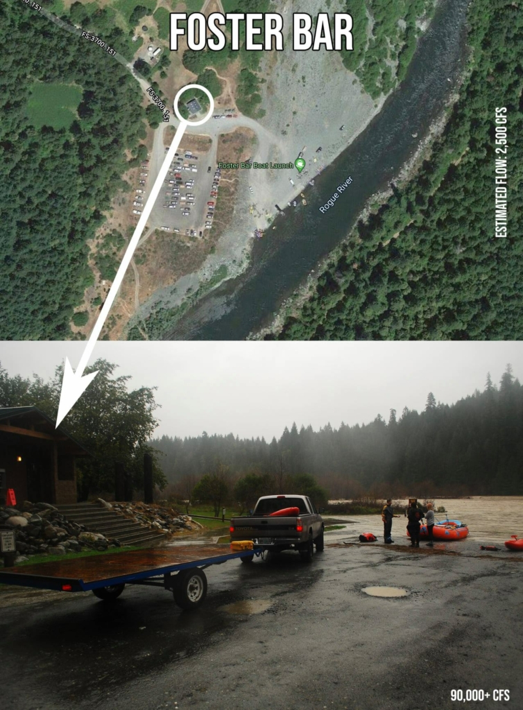
The Rogue River typically flows between 1500 and 5000 CFS in Agness during the summer months. In the winter months, the Rogue occasionally (once every 7 to 10 years) will go over 100,000 CFS. That’s a lot of water, but it’s not as high as the river used to get before the William Jess Dam. The dam was constructed by the Army Corp of Engineers in 1977 to provide flood control. It’s estimated (there were no gauges at the time) that the Rogue River had gone over 250,000 CFS in Agness a handful of times – which caused major flooding to local towns nestled along the river.
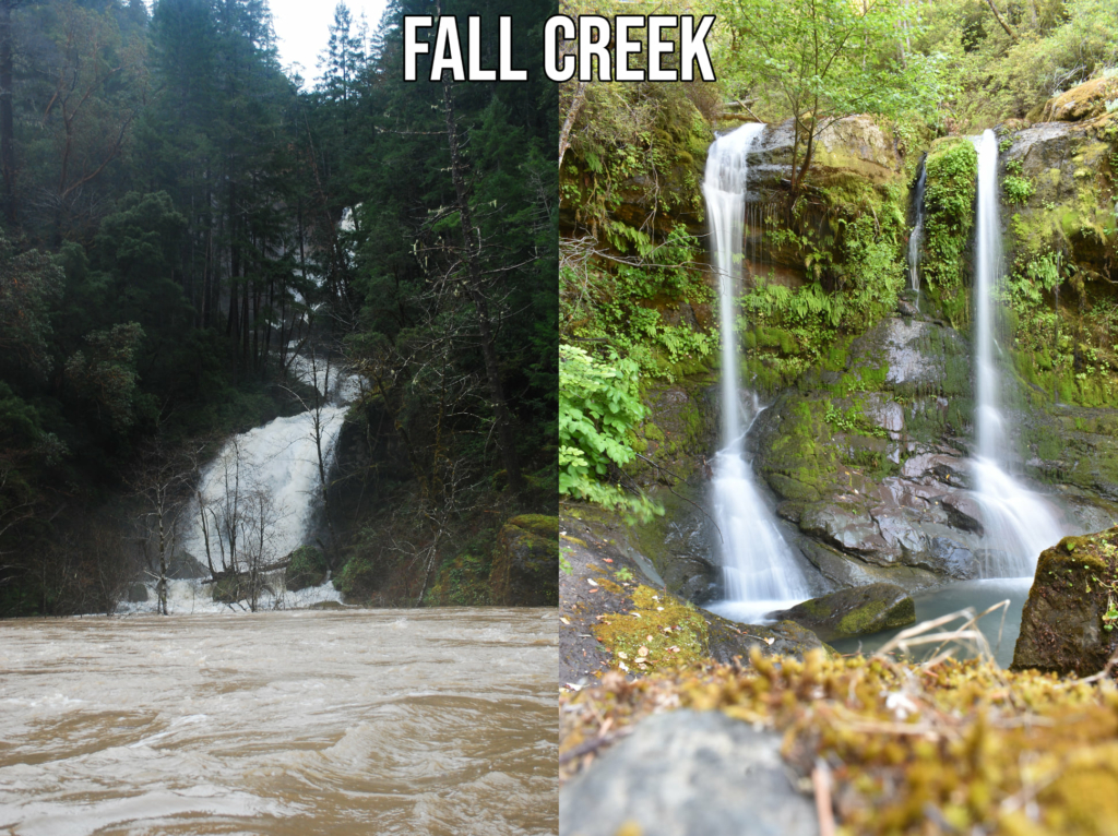
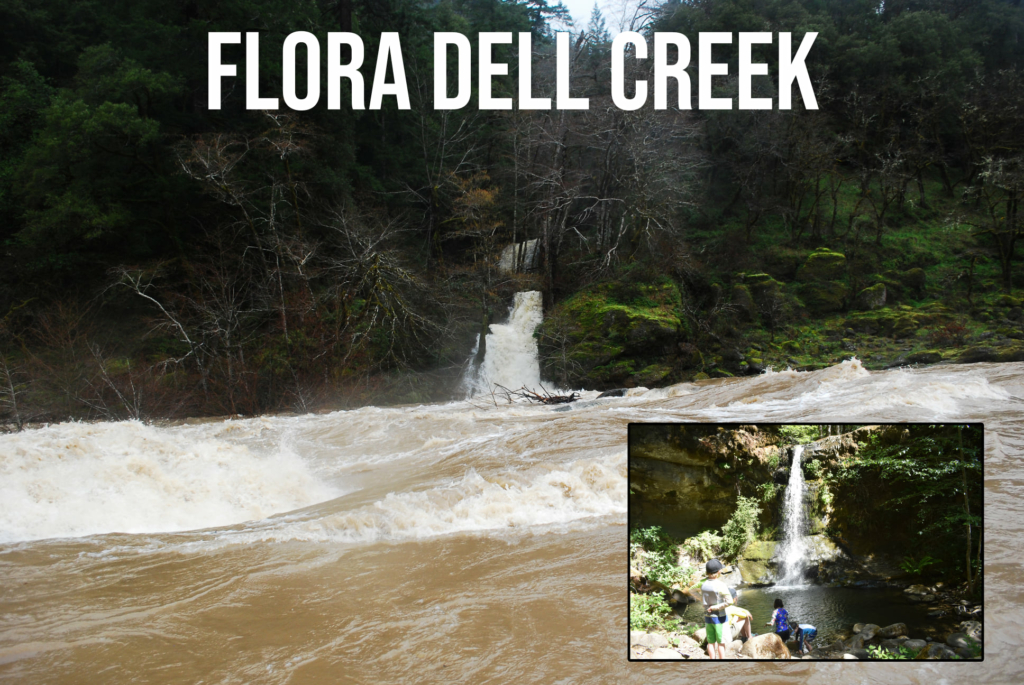
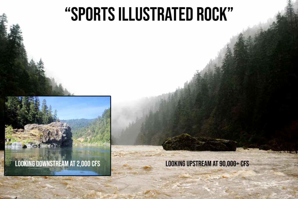
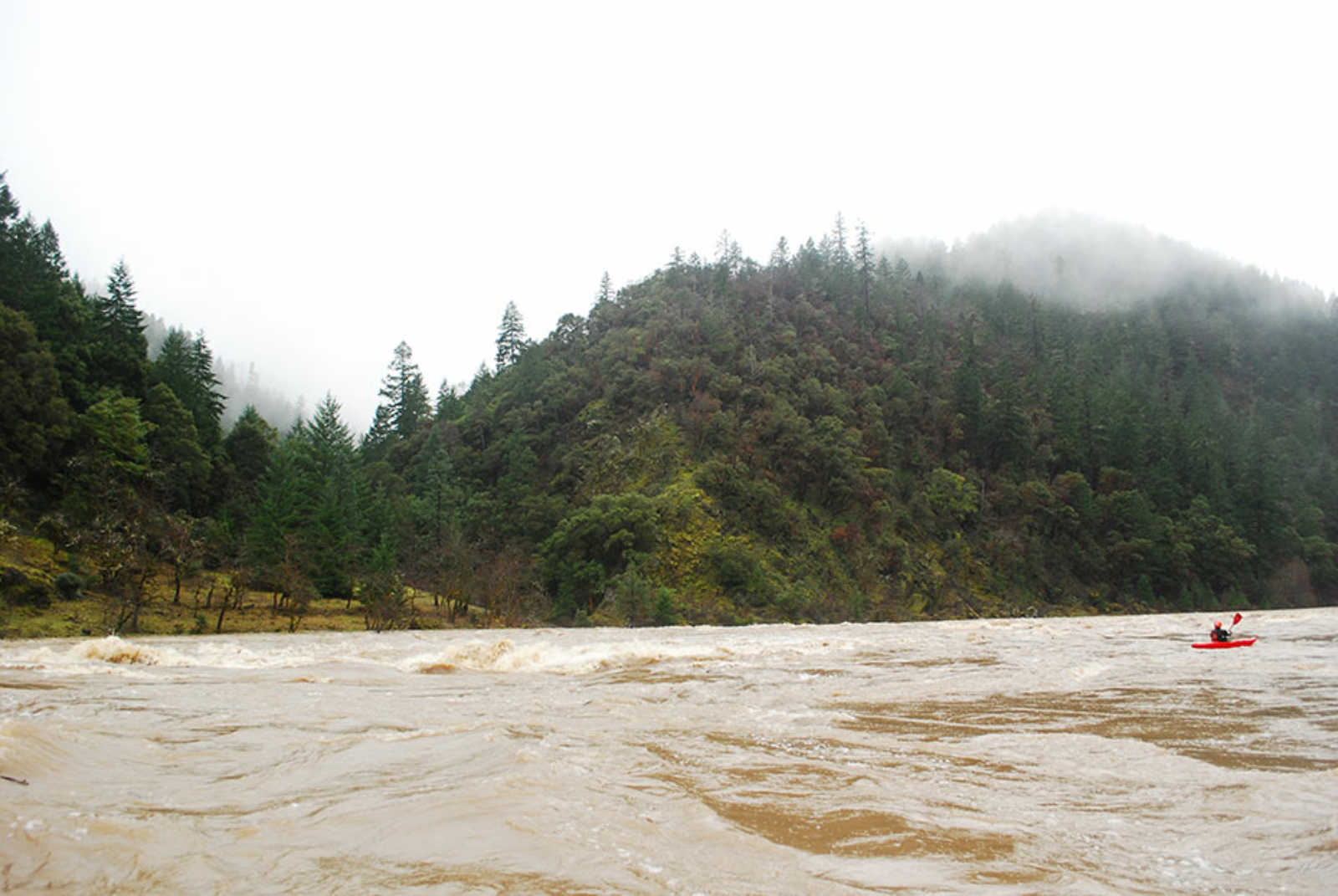
These photos compare normal summertime flows versus a flooding event in February of 2015, when the river peaked at 102,000 CFS in Agness. The high water photos were likely taken somewhere around 90,000 CFS (the river was dropping quickly).